New XMPro Agent Integration: Geofence
We are pleased to announce the exciting addition of a brand new Function Agent, Geofence.
The Geofence Function is used to check whether a certain Latitude and Longitude position is inside or outside a given geographic area. For example, to check if a moving asset is within a geographic area. This function supports Polygonal Geofences.
Polygonal Geofence
A polygonal geofence is created using a set of Latitude and Longitude values which, as the name suggests, represents a polygon.
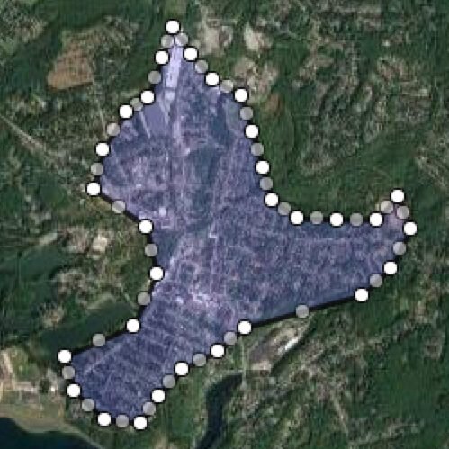
You can use an online tool to create a static geofence file - which is primarily a CSV file of Latitude and Longitude pairs - an example can be found here. Or you can supply the data dynamically for a moving geofence.
Details for examples and configuration can be found in our Documentation.
There are a multitude of use-cases for geofencing that assist organisations across diverse industries to reach their goals. Here are just a few applications within asset-intensive industries such as mining, oil & gas and construction:
- GPS asset tracking
- Big data (efficiency measurement and KPI’s)
- Health & safety (safety zones, restricted areas etc…)
- Device usage limitations
- Automatic work hour reconciliation (geofence check-in, check-out for workers)
- Anti-theft protection
At XMPro, we are continually adding to our library of integrations for enterprise applications, data platforms, AI learning tools, and operational systems. These pre-built Agents enable our clients to effectively extract meaning from different information sources by carrying out specific functions in their data streams. You can explore the full XMPro integration catalogue here.